


Sommet de Banne (Col de Cabre)

Clo0413
User

Length
10.1 km

Max alt
1630 m

Uphill gradient
509 m
Km-Effort
16.9 km

Min alt
1175 m

Downhill gradient
510 m
Boucle
Yes
Creation date :
2023-05-01 08:21:04.24
Updated on :
2023-05-03 17:37:25.583
3h05
Difficulty : Medium

FREE GPS app for hiking
 SityTrail
IGN / Geographical institutes
SityTrail Plus
The world is yours!
About
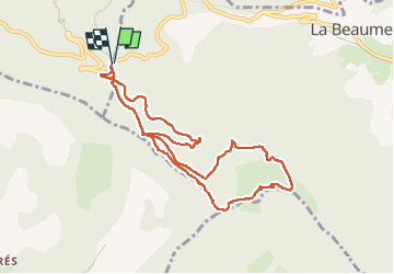
Trail Walking of 10.1 km to be discovered at Provence-Alpes-Côte d'Azur, Hautes-Alpes, La Beaume. This trail is proposed by Clo0413.
Positioning
Country:
France
Region :
Provence-Alpes-Côte d'Azur
Department/Province :
Hautes-Alpes
Municipality :
La Beaume
Location:
Unknown
Start:(Dec)
Start:(UTM)
706395 ; 4936186 (31T) N.
Comments